Cape Perpetua Visitor Center
2400 Highway 101, Yachats, OR 97498
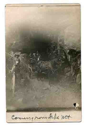
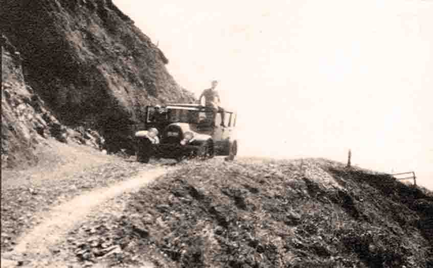
Coming Round the Mountain ~TBD
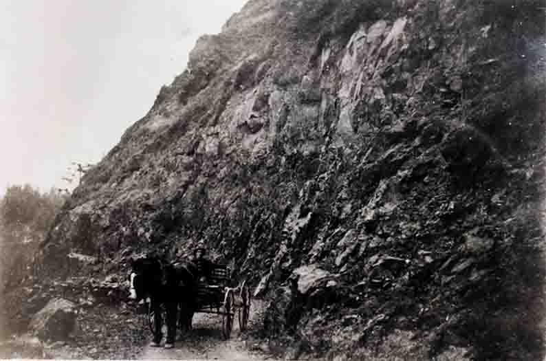
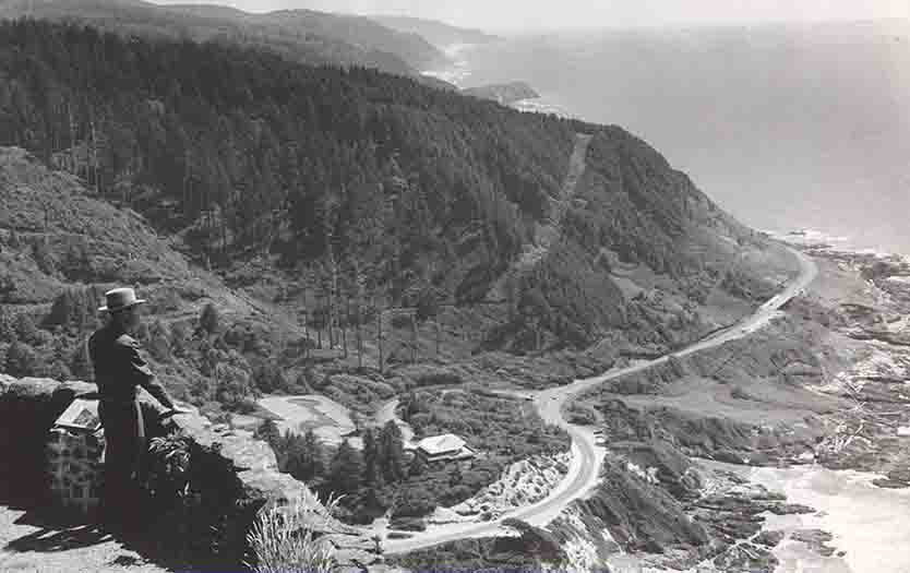
Road around Cape Perpetua blasted out by the Forest Service in 1914 (Then)
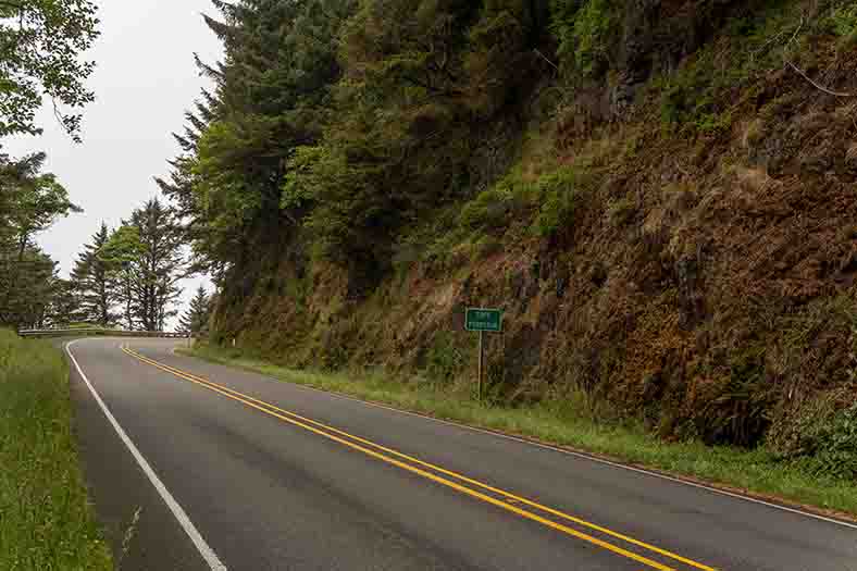
The road around Cape Perpetua in 2019 (Now)
Coming Round the Mountain 1927
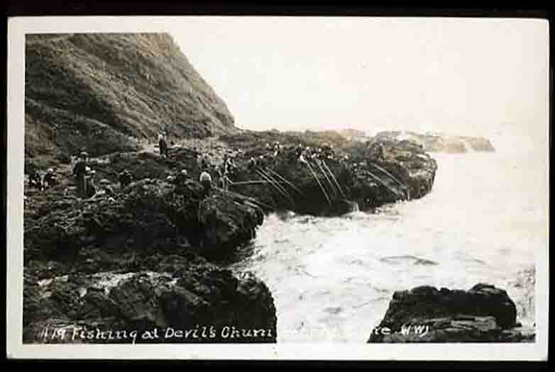
Fishing @ Devil's Churn ~1920
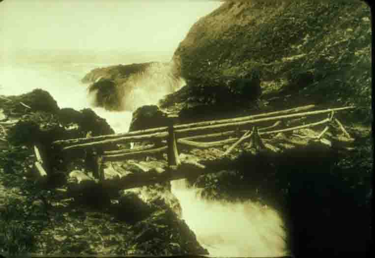
Bridge over Devils Churn 1930
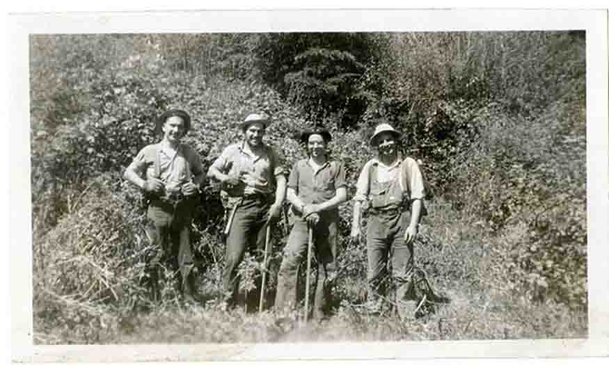
CCC Boys at Cape Perpetua
Cape Perpetua Parapet ~TBD
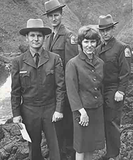
Forest Service Personnel at Cape Perpetua ~TBD
IN THE BEGINING
The coast between Cape Perpetua and Sea Lion caves started forming sixty million years ago, back when you could buy beachfront property in Idaho. During the late Eocene, a volcano erupted beneath the ocean and spewed basalt. Sometime in the last ten million years, the area was uplifted to its present level. During the Pleistocene, about ten to twenty thousand years ago, the sea level was higher than it is now. Eventually, the original volcano emerged as an island, and that island became what we now know as Cape Perpetua.
It's 803 feet (245 m) high, and on top, on a clear day (we've been known to have those sometimes) you can see 70 miles (110 km) of coastline and 37 miles (60 km) out to sea.
Captain James Cook named the promontory Cape Perpetua on March 7, 1778, the feast day for St. Perpetua, a Christian martyr and patron saint of mothers, expectant mothers, ranchers, and butchers. Cook never set foot on the cape, but got stuck in a storm near it for days and said it was "Perpetually in sight."
Cape Perpetua was part of the southern territory of the Alsea people. They called it Halqaik, which probably means something like, "uncovered place," "open place" or "exposed place."
NATIVE AMERICANS
One archaeologist described the state of Oregon as being one vast archaeological site because you can't help but stumble over lithic scatter, evidence of occupation, burial sites, or sacred grounds. They found 14,000-year-old fossilized human poop in a Paisley Cave in central Oregon.
People have been living on the Oregon coast for about 5,000 years. They could have been living here before that, but evidence of their life (and poop) is about four miles (2 km) out to sea.
A 1992 archaeology dig of a shell midden (an ancient refuse heap) at the Devils Churn uncovered millions of shells and fire-cracked rocks from a spring and summer camp. The shells were from mussels (Mytilus californianus), razor clams (Siliqua patula), black katy chitons (Katharina tunicata) and gooseneck barnacles (Mitella polymerus) that taste like lobster.
Shellfish were cooked in watertight baskets. The Alsea made baskets not pottery as pottery would disintegrate in this climate. Baskets were weaved out of hazelnut (Corylus cornuta), Sitka spruce (Picea sitchensis) and western redcedar (Thuja plicata) roots. A well-made basket was highly prized, and many had intricate designs. Rocks were heated in a fire and then put in with whatever was being stewed. Although this might sound cumbersome, it's surprisingly fast.
THE CIVILIAN CONSERVATION CORPS
Cape Perpetua is now part of the Siuslaw National Forest that was created in 1908.
Cape Perpetua's Cape Creek Civilian Conservation Corps (CCC) Camp opened in June of 1933. The 220 men who were between the ages of 17 and 23 weren't at first welcomed with warm enthusiasm by the neighboring communities. In fact, they were referred to as "Captain Cook's Constipated Crew of Chippy Chasers," a chippie being a "lady of the night."
Parents weren't quite as worried about letting their daughters attend dances at the camp after the men had proved their worthiness. A few of the projects they worked on included building picnic sites, trails, and the stone shelter and parapet at Cape Perpetua, planting trees, installing phone lines, and helping construct the Roosevelt Highway (Highway 101).
The CCC was a great source of readily available cheap labor at a time when the goal of the Forest Service was to suppress all fires by 10 a.m. the day after they started. Over 1,000 men from the CCC fought the Tillamook Fire once it blew up and spread from 40,000 to 240,000 acres in 20 hours. Firestorms whirled at hurricane speeds and sent flames 1,600 feet in the air.
The men earned $30 per month. They only got to keep $5.00. The rest was sent home and was often their family's primary source of income. Even in the Depression, $1.00 per day was considered to be a low wage, but the CCC was mainly used as a method of getting thousands of the unemployed off the streets and into productive labor.
The CCC was abolished in 1942 because of rapidly rising employment rates and dwindling enrollment in the Corps. The facilities at Cape Creek were burned a few years later.
WWII
In 1943, after a failed bombing attempt by the Japanese near Brookings (an interesting story in itself), the Portland District Army Engineers set up a SCR-270 (Set Complete Radio model 270) radar station on Cape Perpetua. Eventually, they moved to the hills above Yachats so they could get better reception.
CAPE PERPETUA VISITOR CENTER
In the 1960s the Forest Service designated the 2,700-acres around Cape Perpetua to be a Scenic Area. The Cape Perpetua Visitor Center, dedicated in 1967, has cultural and natural history displays. The scenic area has among other things, The Spouting Horn, Devils Churn, Thor's Well, The West Shelter, old-growth forest, archaeological sites, Oregon's largest marine reserve and protected area, and over 26-miles of hiking trails.
One of those is Amanda's Trail, a trail dedicated to a blind Native American forcibly marched to the Oregon Coast Reservation Sub-Agency in Yachats.